|
Moderated by NW Okie! |
Volume 12 , Issue 212010Weekly eZine: (375 subscribers)Subscribe | Unsubscribe Using Desktop... |
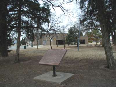
Council Grove, Oklahoma

 "During the run of 1889 there was a 9 section area of land held back from homesteading, bordered by what is now Melrose Lane on the south; the canadian river on the west. To 174 mile North of NW 36th and going East to present Ann Arbor Street.
This land was posted so that it would not be homesteaded by a double furrow plowed around it. This heavily worked area was known by various names, such as: the Grove; the woodpile; and the woodlot.
Wood from this reserve was for the use of Ft. Reno and was guarded by cavalry troopers. The trooper erected a stockade approximately 1/4 mile East and 225 yards North of this reserve when the fort had no more use for the land it was appraised by a washington appraiser and auctioned at a brush arbor set up near the west edge of the reserve.
At the first sale, held in 1899, the land sold in 40 acre lots for about two dollars per acre. Another sale was held some years later and the land sold for ___ to $17.00 per acre.
One of the first schools opened in Oklahoma county was located originally on West Reno. Later it was moved by wagon to the corner of Melrose Lane and Council Road. A second school building was constructed in 1900 and the present red brick structure was erected in 1938. It is the third stand on that site.
On June, 1892 a post office was established just North of the present railroad crossing on Council Road. It was first named Council Grove, but on December 7, 1894, the name was changed to Council and was discontinued August 15, 1906. This structure served as a general store and was also a ticket agency for the Choctaw Oklahoma and Gulf railroad which eventually became the Rock Island.
The marker stands on part of the original homestead of Mr. and Mrs. Isaac F. Melrose and the land for the marker was donated by Mr. and Mrs. Dana R. Melrose. Oklahoma Historical society.
| View or Add Comments (0 Comments)
| Receive
updates ( subscribers) |
Unsubscribe
| © . Linda Mcgill Wagner - began © 1999 Contact Me | |
