|
Moderated by NW Okie! |
Volume 10 , Issue 292008Weekly eZine: (374 subscribers)Subscribe | Unsubscribe Using Desktop... |
OK Map Circa 1900 & Cache Creek

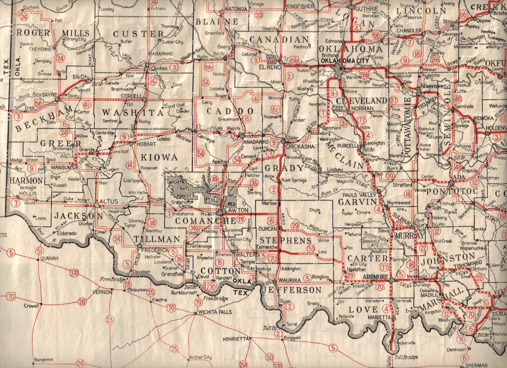
"Cache Creek and its many tributaries is shown on the map of Oklahoma and Indian Territories circa 1900. I see it (and West Cache) extending from the area about 40 miles north of the military reservation at Fort Sill in the Kiowa and Comanche counties on down to where they join Deep Red Run which feeds into the Red River near the southeast corner of what is now Cotton County. It is NOT near Altus. That one was the "Elk". The Cache probably feeds what is now known as Lake Ellsworth and one of its tributaries (I think) would also feed Lake Lawtonka. The Cache is also found on this 1928 map of Oklahoma Highways." Roy
| View or Add Comments (0 Comments)
| Receive
updates ( subscribers) |
Unsubscribe
| © . Linda Mcgill Wagner - began © 1999 Contact Me | |
