|
Moderated by NW Okie! |
Volume 15 , Issue 302013Weekly eZine: (366 subscribers)Subscribe | Unsubscribe Using Desktop... |

History of Grant County, Kansas
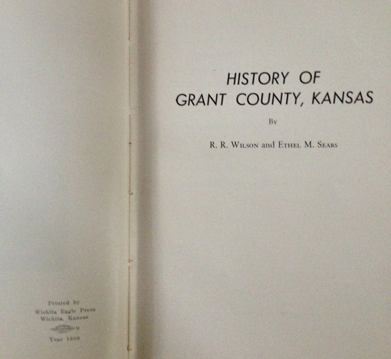
At a garage sale a few weeks back, I purchased for fifty-cents this thin green, hardback book, History of Grant County, Kansas, compiled by Wilson, R.R. and Ethel M. Sears.
Published by Wichita Eagle Press, Wichita, Kansas, 1950. We looked online for similar books and found on ebay and other sites where this autographed signed book by R. R. Wilson, is selling for over $100. Quite a find for 50-cents, huh?
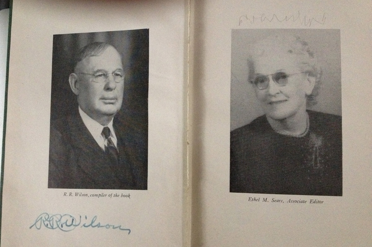 On the inside cover another persons name is written across the top. I am assuming in 1951, "Katie Puls" was the owner of this signed Kansas history book of Grant County, Kansas. If you have known or knew of Katie Puls and her family, please let them know that the "History of Grant County, Kansas" is in good hands with this NW Okie historian. Thanks!
In the front pages of the book there is a poem written by Judge Herbert Rhoades, Omaha, Nebraska, entitled "Somehow." Also, Judge Herbert Rhoades was county attorney, Grant county, from 1908-1913.
Somehow
Western Kansas kind of gets you
You leave its paths behind;
Only to find you, somehow,
Can't get it from your mind;
The shadows of the summer's eve
The columns in the snow
Seem to keep calling, somehow,
No matter where you go.
Your steps just seem to travel
The old familiar gait;
And like old friends the buildings
And the lowing cattle wait --
Almost before you know it
Your feet will take the track
And like a homesick pilgrim
You'll come a roaming back.
Chapter 1, Opening of the Country
It is believed that the Kansas that belonged to Spain was visited by Coronado in 1541, although there is little left to tell of that legendary march. United States took possession of the territory March 10, 1804. In 1822 the Santa Fe Trail was established, thus opening the trail from Independence, Missouri to Santa Fe, New Mexico.
Kansas was originally occupied by four great tribes of Indians; the Comanches, Kansas, Osages and Pawnees. They were dreaded foes of the emigrants traveling on the Santa Fe Trail. One method of attack was to encircle the wagon trains and kill and scalp their victims. Many times the Indians drove off their stock or killed it in a sprit of deviltry. The treat of 1867 ended their claim to the territory, yet it was not until late in the 1870's that they left the country in large numbers.
The state of Kansas is a part of a great plain extending from the Mississippi River on the east to the Rocky mountains on the west. It is approximately 200 by 400 miles in extent. In the eastern part the average elevation is approximately 850 feet, while near the western boundary it rises to 3,500 to 4,000 feet elevation above sea level. In the northern part of the state the surface rises uniformly from the Missouri River, while in the south it is irregular and both rises and falls. Many rugged bluffs and valleys mark the southeastern part of the state.
The waters generally flow eastward with a fall of as much as eight feet to the mile in some places.
The Kansas-Nebraska bill, defining the territory of Kansas, was passed May 30th, 1854 and in that year Leavenworth, Lawrence, Atchinson and Topeka were founded. Andrew H. Reeder became the first governor of Kansas. In 1861 Kansas became a state.
During the years of the Civil war Kansas was exposed to invasion by confederate forces, to raids by the Indians and by Quantrill's guerillas. Quantrill's raids added a dark chapter to the history of Kansas. The Cheyennes broke their treaty in 1874 and laid waste three counties on their way to the north and killed many people.
Establishment of Grant County
According to George W. Martin, secretary of the Kansas Historical society, in 1873 that part of Kansas west of Range 25 west was divided into twenty-five new counties and twelve changes were made in the counties already established. The new counties were Decatur, Rawlins, Cheyenne, Sheridan, Thomas, Sherman, Lane, Buffalo, Foote, Meade, Scott, Sequoyah, Arapahoe, Seward, Wichita, Kearney, Grant, Stevens, Greely, Hamilton, Stanton and Kansas.
In 1883 kearney, Sequoyah, Gray, Grant, Arapahoe, Kansas, Stevens, Meade and Clark counties disappeared. Hamilton, Ford, Seward and Hodgman were enlarged and Finney created to include the territory of the first named counties. In the redistribution of this territory the fourth standard parallel became the north line and the sixth standard parallel the south line of Hamilton, Finney and Hodgman counties. Hamilton extended east to the east line of range 37W; Finney beginning there extended tot he east line of range 29W, and Hodgman extended from that line to the east line of Range 21W. The south line of Hodgman was the south line of township 24. Ford occupied the district south of Hodgman and Seward was bounded on the north by the sixth standard parallel and on the west by the east line of range 29W, and extended to the western and southern boundaries of the state. Township 21 of range 27 to 30 was detached from Lane and the first two attached to Hodgman, and the last two to Finney. Finney was organized in 1883.
In 1887 the area of Finney, Hamilton and Ford counties was reduced. Haskell was created out of that part of Finney which had been established as Arapahoe in 1873. For, Hodgman and Hamilton again took the boundaries of 1873, and Grant, Stanton and Kearney were established with their former boundaries. In 1888, the last of the counties, Grant, Greeley and Kearney were organized; the east half of Grant came from Finney county and the west half from Hamilton county.
Grant county, generally speaking, is rather flat, with the exception of Bear Creek, which runs through the northwestern corner of the county, and the South Cimarron, which runs through the southern part of the county. Bordering it are bluffs. The North fork of the Cimarron makes a bend near Ulysses and goes south east.
In the early days the gourd was covered with short grass, called baffle grass. There were no trees.
As early as 1885 the settlers began coming to enter the land. There were different laws under which they could obtain title to public land.
Kansas State School Land
This applied to section 16 and 36 in each congressional township. A person over twenty-one years of age could settle on a quarter section of school land, make a six weeks residence and get patent to the land by paying $3.00 per acre, later changed to $1.25 per acre.
Government Land, Preemption Las
Not over 160 acres was allowed to one person and required payment of $1.25 per acre. Proof must be made within twelve months, or would be made within six months, the applicant being required to improve the land and reside on the land six months or more out of each year.
General Homestead Law
Under the General Homestead law a person could enter as much as 160 acres of land, improve and cultivate a certain portion of said land, making it his or her home for a term of five years and not over seven years, and acquire patent to land without any cost other than proof fees. In later years this was changed to three to five years.
The Timber Culture Act
This was often referred to as the timber claim or tree claim. Under the act one could file on 160 acres or less. This act did not require any residence but a certain amount of cultivation and the planting and grown go a certain number of trees for a period of eight years. Only one timber claim was permitted in each section. This timber culture was not a success in Grant county because of the drought during some years. After a great number of people failed to grow the number of trees required the government allowed them to make proof and receive patent to the land where they could show in the final proof by claimant and two witnesses that they had either planted trees or tree seeds for a certain number of years. The Timber Culture Act was finally repealed.
Applicants To Enter Land
An applicant to enter any of this land was required to be the head of a family or a single person who had attained the age of twenty[one years and was a citizen of the United states, or had declared his intention to become such, and had made no previous entry.. A person was allowed to settle on a preemption and timber claim or a homestead and timber claim at the same time. In the early days a great many settlers succeeded in getting a homestead and a timber claim or a preemption and timber claim in the same section.
| View or Add Comments (0 Comments)
| Receive
updates ( subscribers) |
Unsubscribe
| © . Linda Mcgill Wagner - began © 1999 Contact Me | |