|
Moderated by NW Okie! |
Volume 9 , Issue 372007Weekly eZine: (366 subscribers)Subscribe | Unsubscribe Using Desktop... |

1893 -
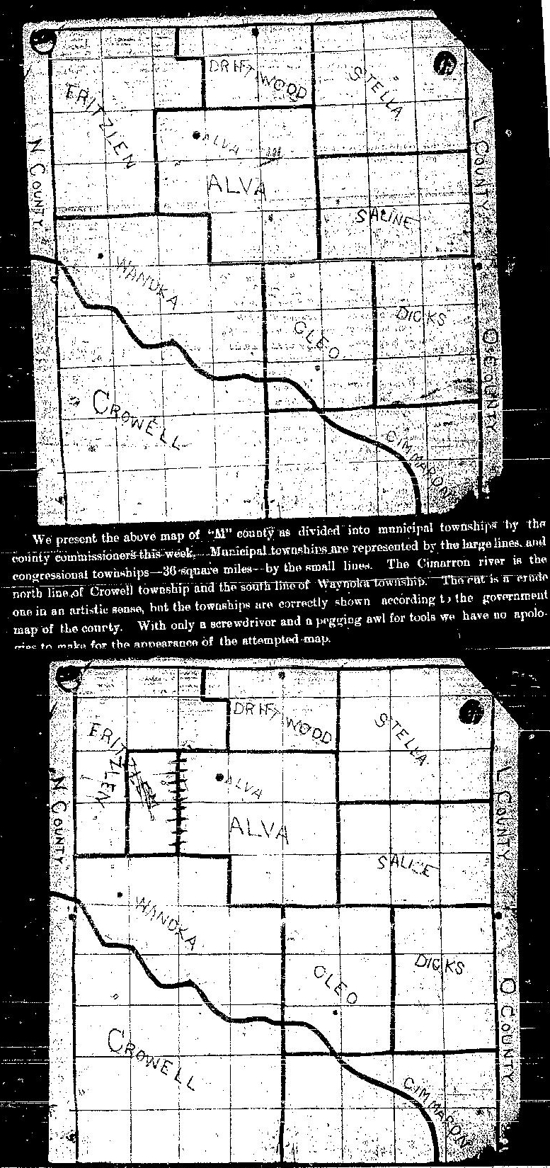
The Alva Pioneer, in Alva, M County, O.T., dated Friday, January 12 & 19, 1894 had a drawing of "M" county that the county commissioners had drawn up on January 12, 1893 and updated a week later on January 19, 1894.
The January 12, 1894 article with drawing read: "We present the above map of "M" county as divided into municipal townships by the county commissioners this week. Municipal townships are represented by the large lines, and congressional townships -- 36 square miles- -- by the small lines. The Cimarron river is the north line of Crowell township and the south line of Waynoka township. The cut is a crude one in an artistic sense, but the townships are correctly shown according to the government map of the county. With only a screwdriver and a pegging awl for tools we have no apologies to make for the appearance of the attempted map."
The updated portion (January 19, 1894) shows a line between the Fritzlen and Alva townships redrawn. The county commissioners changed the lines of the Fritzlen townships, by adding the east portion of Fritzlen to the Alva township. They scratched out the old line and added a new one to their map. That map is below the original map of January 12, 1894.
At that time townships that made up M County were: Fritzlen, Driftwood Stella, Alva, Saline, Waynoka, cleo, Dicks, Crowell, Cimmaron. M county was bordered on the east by L & O county and on the west by N county.
| View or Add Comments (0 Comments)
| Receive
updates ( subscribers) |
Unsubscribe
| © . Linda Mcgill Wagner - began © 1999 Contact Me | |