|
Moderated by NW Okie! |
Volume 6 , Issue 112004Weekly eZine: (366 subscribers)Subscribe | Unsubscribe Using Desktop... |

Welcome to the Historic Santa Fe Trail...
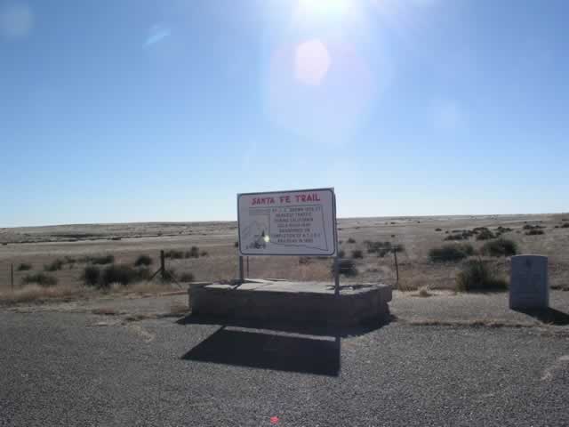
As we reached the eastern side of Black Mesa, we came upon this historical marker that welcomed us to the Historic Santa Fe Trail & Fort Nichols. We learned that the Santa Fe Trail was surveyed by J. C. Brown, in 1826-27 -- that the heaviest traffic was during the California Gold Rush of 1849 -- it was abandoned on completion of A.T. & S. F. Railroad in 1880.
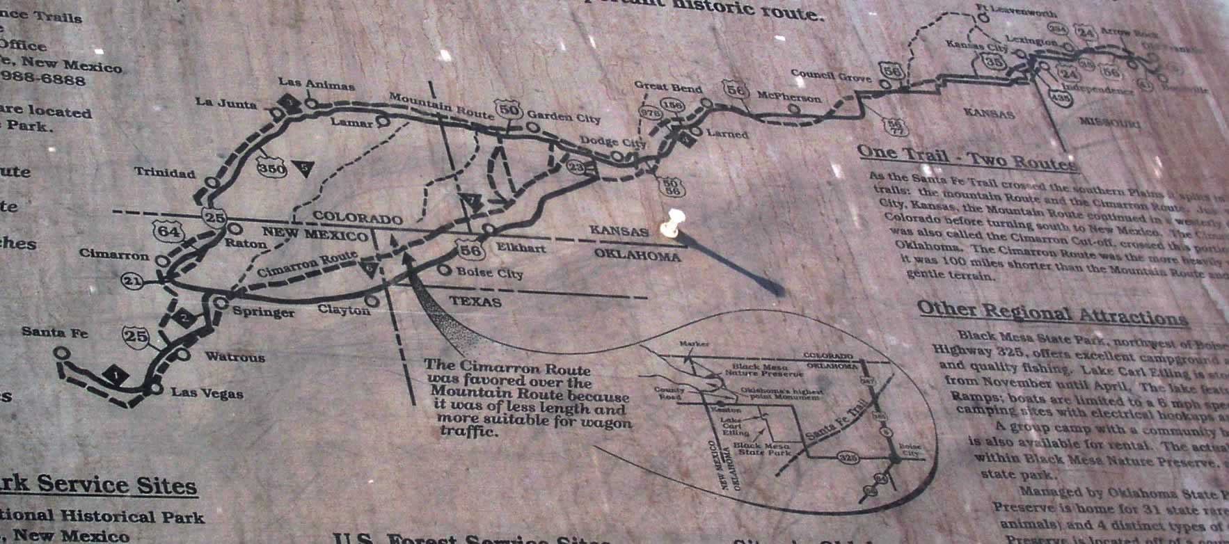 The state park has maps that identify the auto tour routes which are in proximity to the trail. You can travel the auto tour, stopping at local chambers of commerce, museums and information centers to learn more about this important historic route. Some of the items marked on the map are the National Park Service Sites...
1. Pecos National Historical Park - Pecos, New Mexico;
2. Fort Union National Moonument - Watrous, New Mexico;
3. Bent's Old Fort National Historic Site - LaJunta, Colorado;
4. Fort Larned National Historic Site - Larned, Kansas. The U.S. Forest Service Sites are marked as...
5. Comanche National Grassland - Springfield, Colorado;
6. Kiowa National Grassland - Clayton, New Mexico;
7. Cimarron National Grassland - Elkart, Kansas. If you want more information, contact (write) Branch of Long Distance Trails -- National Park Service -- Southwest Regional Office -- PO Box 728 -- Santa Fe, New Mexico 87504-0728 -- (505) 988-6888. Copies of the map are located at Black Mesa State Park.
The state park has maps that identify the auto tour routes which are in proximity to the trail. You can travel the auto tour, stopping at local chambers of commerce, museums and information centers to learn more about this important historic route. Some of the items marked on the map are the National Park Service Sites...
1. Pecos National Historical Park - Pecos, New Mexico;
2. Fort Union National Moonument - Watrous, New Mexico;
3. Bent's Old Fort National Historic Site - LaJunta, Colorado;
4. Fort Larned National Historic Site - Larned, Kansas. The U.S. Forest Service Sites are marked as...
5. Comanche National Grassland - Springfield, Colorado;
6. Kiowa National Grassland - Clayton, New Mexico;
7. Cimarron National Grassland - Elkart, Kansas. If you want more information, contact (write) Branch of Long Distance Trails -- National Park Service -- Southwest Regional Office -- PO Box 728 -- Santa Fe, New Mexico 87504-0728 -- (505) 988-6888. Copies of the map are located at Black Mesa State Park.
| © . Linda Mcgill Wagner - began © 1999 Contact Me | |