1931 Road Map of New Mexico
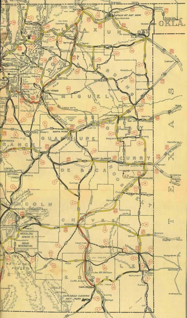
This 1931 Road Map of New Mexico belonged to Bob McGill (15 years of age). I am assuming the trip began at Boise City, Oklahoma heading west towards Kenton, Oklahoma on US-64 to the New Mexico towns of Folsom, Capulin, Des Moines, and Clayton. Turning around at Clayton and backtracking his route back to Capulin and Raton.
Then it takes a turn south down US-85 to Las Vegas, taking off on US-66 southeast towards Santa Rosa and then heading east on US-54 through Cuervo, Newkirk, Montoya and Tucumcari. It then heads south towards Ragland and Clovis. Then the trip heads south on US-366 through Portales, Flida, Kenna and Roswell.
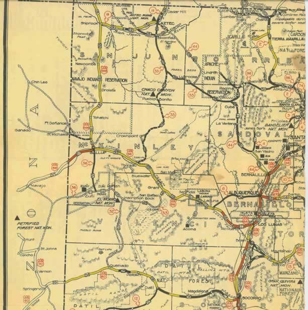
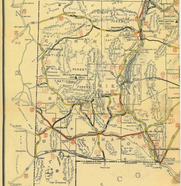
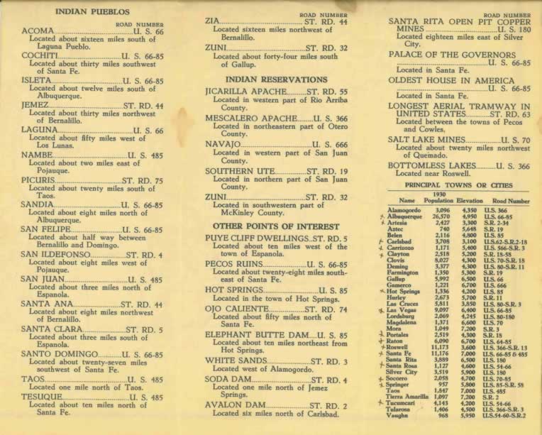
If you follow the faint pencil marks, it shows the route winding south through Hagerman, Artesia, near Lake Avalon and to Carlsbad. It appears that he penciled a trip back north to Roswell but took an easterly route on US-62 towards Caprock and down to Lovington at one point and then back again towards Artesia. I have scanned this map in 5 parts. The first three are the map itself and the last two shows New Mexico sites, population and traffic regulations.
* New Mexico East (click image above)
* New Mexico Upper West
* New Mexico Lower West
* New Mexico Sites & locations
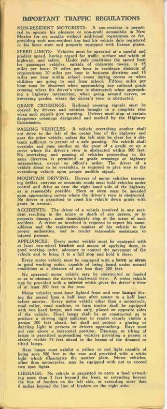
* New Mexico Traffic Regulations
| View or Add Comments (0 Comments)
| Receive
updates ( subscribers) |
Unsubscribe
