|
Moderated by NW Okie! |
Volume 11 , Issue 482009Weekly eZine: (366 subscribers)Subscribe | Unsubscribe Using Desktop... |

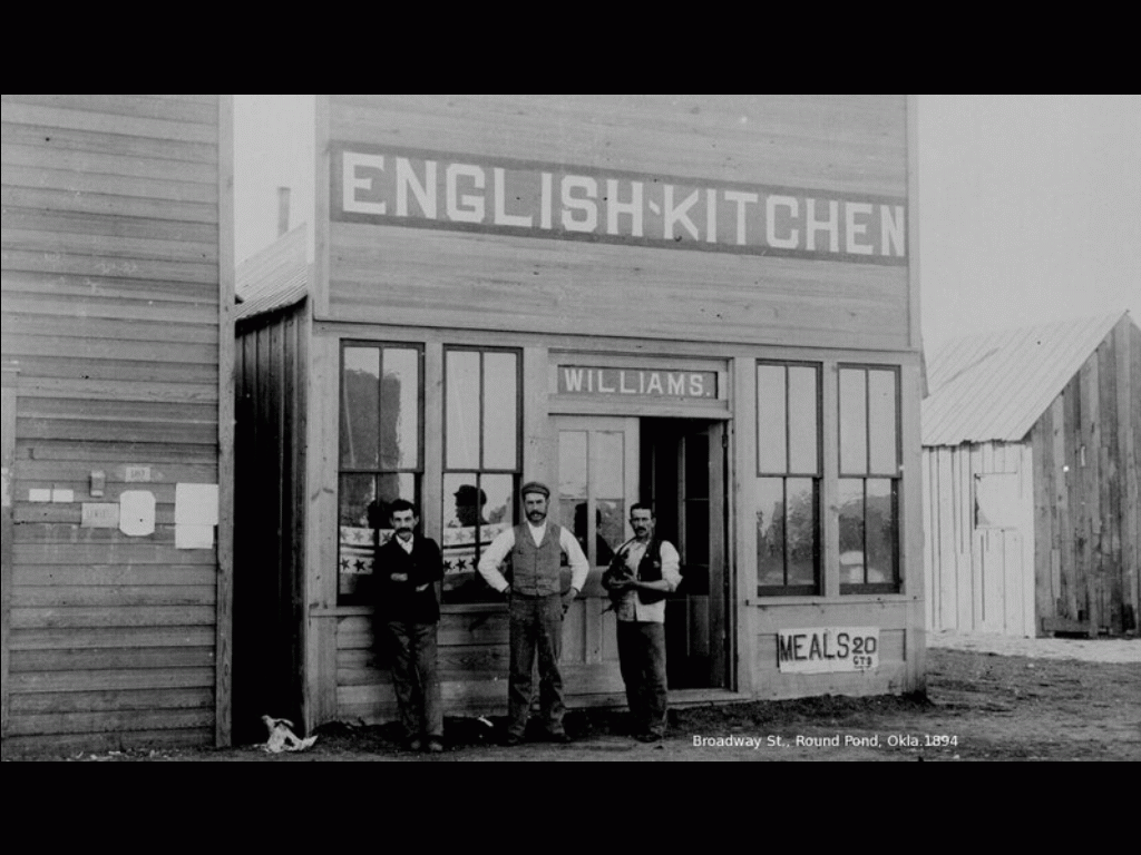
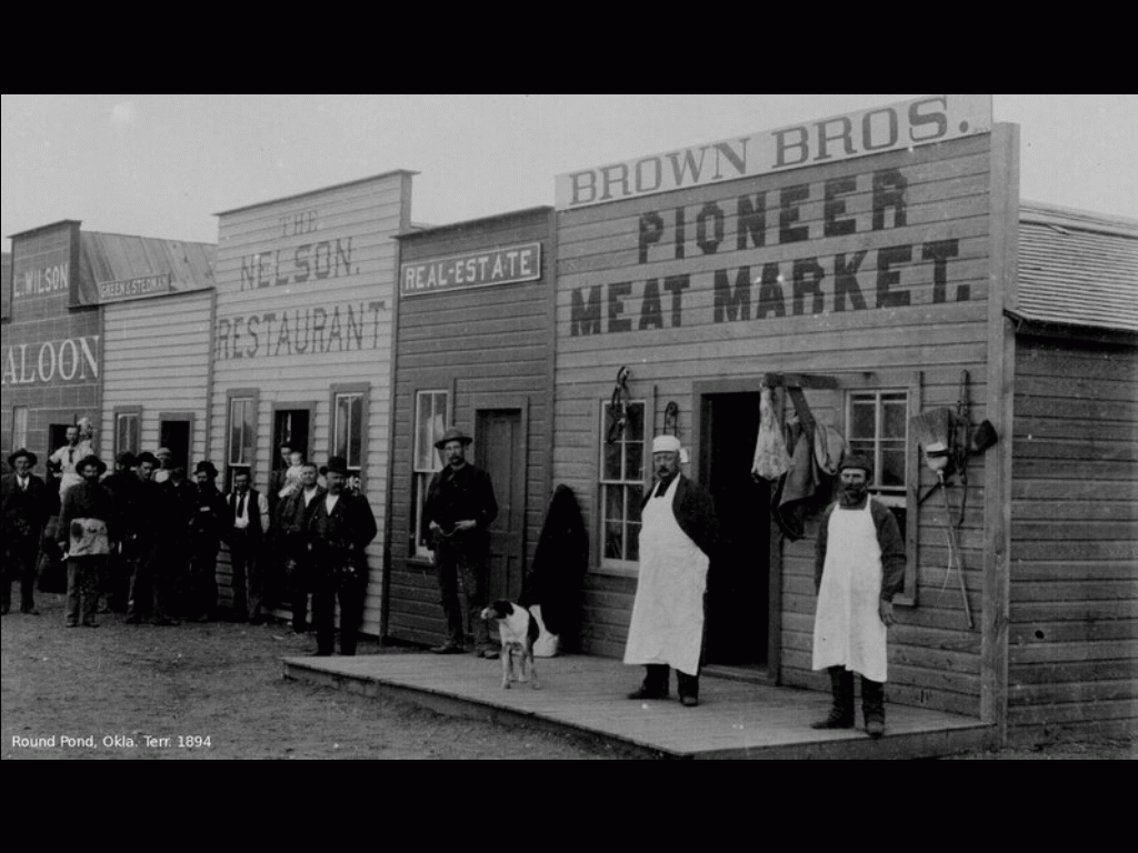
Round Pond, Oklahoma Territory (OT)
 "Just south of the Kansas border, in Indian Territory?s 58-mile-wide Cherokee Outlet (sometimes incorrectly referred to as the Cherokee Strip), they chose a spot about a mile north of the Salt Fork River, where, back in 1866, explorer James R. Mead had established a trading post that was known as Round Pond. By 1873 it had developed into a combination stagecoach station, supply store and cattle ranch called Pond Creek. Twenty miles farther south, surveyors mapped a possible townsite near a stagecoach station called Skeleton Ranch.
"By the summer of 1888, the Rock Island?s subsidiary, the Chicago, Kansas & Nebraska Railway, had laid track from Caldwell, Kan., to Pond Creek, and by 1892 the line reached Texas. At the proposed townsites of Round Pond and Skeleton Ranch, the railroad had put in sidetracks, water tanks and small depots, even though the Cherokee Outlet still belonged to the Cherokees. Ownership, however, was about to change.
In early 1893, the federal government yielded to growing pressure to open the Outlet for settlement by purchasing it from the Cherokee Nation. United States Secretary of Interior Hoke Smith quickly organized a public land opening, setting September 16 as the day for the land run. (For more on Oklahoma?s land runs, see the October 2007 issue of Wild West.) Smith named former Alaska Territorial Governor Alfred P. Swineford as inspector of surveys, a job that entailed locating land offices and county seats.
"Where the rail line crossed the Outlet, Swineford?s choice was easy. He platted land around the Rock Island?s depot at Pond Creek for a county seat town in what was to become ?L? County (later Grant County). He called it ?Round Pond,? the same name given the area by explorer Mead years earlier. Similarly, Swineford selected land bordering the Rock Island?s tracks near Skeleton Ranch for a townsite called ?Enid,? the county seat of ?O? County (later Garfield County). Available water and timber made both locations even more attractive, and although the Department of Interior initially accepted Swineford?s recommendations, the plan soon changed.
"A few days before the September 16 land run, ranking Interior officials rejected the two locations. The reason, although unclear at the time, apparently involved Indian land allotments, a right given the Cherokees by treaty. In his history of the Rock Island Railway, Iron Road to Empire, William Edward Hayes claimed the government?s last-minute rejection resulted from the discovery that ?railway officials? had conspired with Cherokee Indian leaders to control property around the sites. Other historians blame U.S. Senator Robert L. Owen, a Cherokee lawyer, lobbyist and agent for the Five Civilized Tribes, who reportedly conspired ?illegally? with tribal leaders to select the most valuable allotments.
"Ultimately, when U.S. Land Office Commissioner Silas Lamoreaux reviewed the townsite selections, he realized that Indians owned several large pieces of property adjacent to the Round Pond and Enid townsites. Believing that prospective settlers would not be ?best served by townsites almost surrounded by Indian allotments? and suspicious of a railroad effort to exploit settlers, Lamoreaux recommended changes.
"Secretary of Interior Smith, an attorney who had made a career of prosecuting damage suits against railroads, was more than happy to preempt any chance of railroad skullduggery in Oklahoma Territory. Smith relocated the Round Pond and Enid townsites three miles south of the original locations, changes that would soon create havoc." -- historynet.com
Al says, "A friend of mine sent me these pictures of Round Pond, OT, that is currently Jefferson, OK. The townsite was officially moved three miles South and renamed Pond Creek sometime around statehood.(Oklahoma Place Names, 2nd edition.)"
Candace and I are in Rutherford County, NC, watching Autumn spiral over the landscape. Snug in our cabin, there's little to do but read and catch the local events. So far the Linville, NC caverns and the Spindale (mill town) arts and antiques show. Candace is a Florida girl, and fascinated by the snow and turning leaves. Snow is scarce here in the isothermal zone, but we saw it on New Years' day a couple of years ago.
| View or Add Comments (0 Comments)
| Receive
updates ( subscribers) |
Unsubscribe
| © . Linda Mcgill Wagner - began © 1999 Contact Me | |