|
Moderated by NW Okie! |
Volume 11 , Issue 262009Weekly eZine: (366 subscribers)Subscribe | Unsubscribe Using Desktop... |

1848 US Map of North America
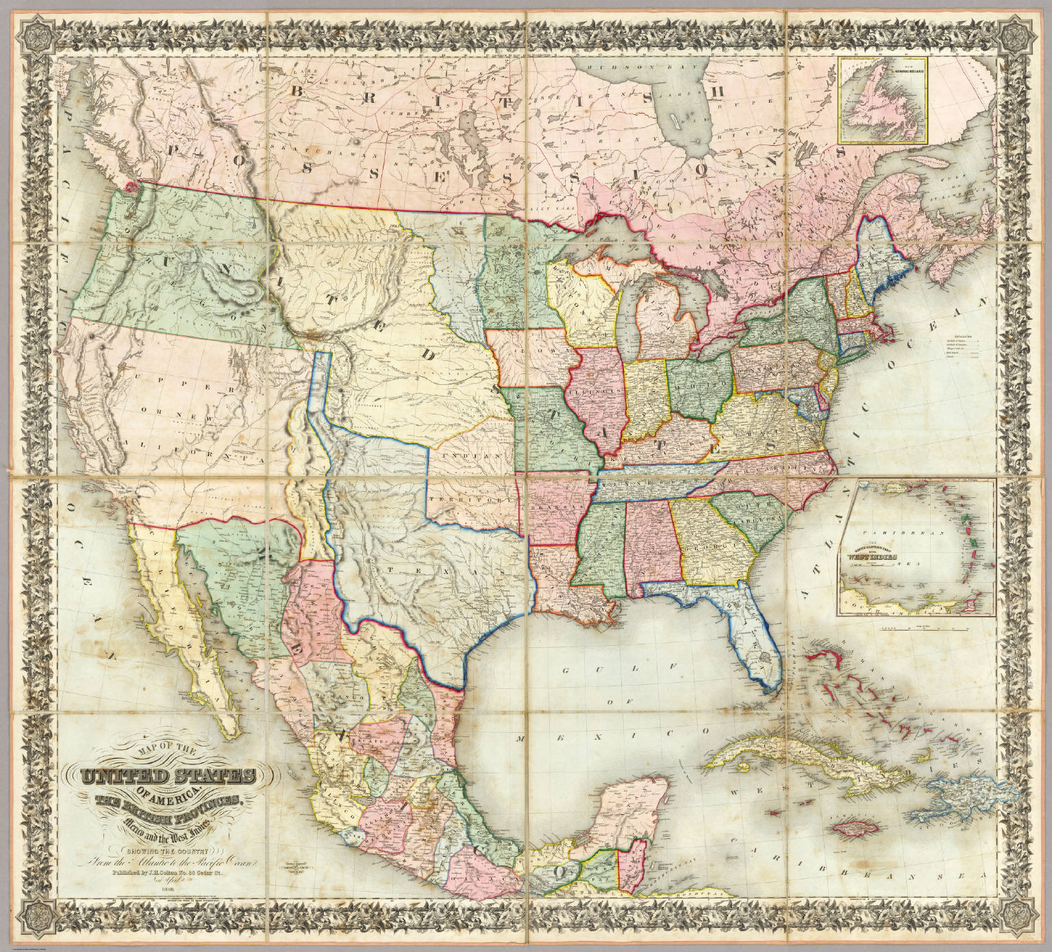
We found this Great 1848 US Map over at www.davidrumsey.com. It states that it is a "Third edition, first being 1846 (according to Ristow, although Karrow only lists an 1847). Texas is still in large configuration with a panhandle running up to Oregon. California and the Great Basin are shown only as Upper or New California.
"Fremont's 1843 and 1845 maps are incorporated, but not the 1848 map. The title is in the lower left, with an inset map of the West Indies and an inset of Newfoundland. In the 1850 edition the title is moved to the upper right. In the 1853 edition it is moved to the upper left.
"Map is dissected into 16 sections and edged in pink silk. Full color by state. Folds into green and pink plaid end sheets and half leather marbled covers 38x35 with ties and a label reading "United States" in elegant manuscript.
"Map Of The United States Of America, The British Provinces, Mexico and the West Indies, Showing The Country from the Atlantic to the Pacific Ocean. Published by J.H. Colton, No. 86 Cedar St. New York. 1848. Entered ... 1846, by Joseph H. Colton ... New York. Drawn & Engraved By Sherman & Smith New-York. (inset) The south Eastern Part Of The West Indies. (inset) Map Of Newfoundland." -- davidrumsey.com/maps6150.html
| View or Add Comments (0 Comments)
| Receive
updates ( subscribers) |
Unsubscribe
| © . Linda Mcgill Wagner - began © 1999 Contact Me | |