|
Moderated by NW Okie! |
Volume 11 , Issue 52009Weekly eZine: (366 subscribers)Subscribe | Unsubscribe Using Desktop... |

Ashley Oklahoma Territory Plat & Map
The Plat of Ashley, Oklahoma Territory has been scanned to these PDF files at the following links: Ashley, O.T. Woods Co. - pdf file - AND - PDF File - Ashley, O.T. Plat
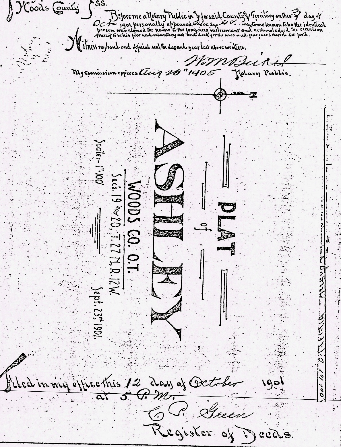
It starts out reading: Territory of Oklahoma, Woods County ss - Before me a Notary Public in and of forsaid County and Territory on this 3 day of October, 1901, personally appeared (Henry G. Perring) to me known to be the identical person who signed the name to the foregoing instrument and acknowledged the execution thereof to be his free and voluntary act and deed for the uses and purposes therein set forth.
Witness my hand and official seal the day and year last above written.
WM Bickel
My commission expires Aug. 28, 1905, Notary Public
Plat of Ashley, Woods Co., O.T. Sec's. 19 and 20, T. 27 N, R. 12W.
Scale: 1in-100ft -- Sept 23, 1901
Filed in my office this 12 day of October 1901 at 5 p.m.
C. A. Green, Register of Deeds
Territory Oklahoma - Woods County ss
This is to certify that J. A. Stine and Emma J. Stine have caused the following described lands in Woods County, Oklahoma Territory to wit. Being a part of the SouthEast quarter of Section 19, in Township 27 North of Range 12 W of the Indian Meridian and particularly bounded and described as follows to wit: commencing at a point 150 feet South of the North East corner of said quarter section, running thence South along the East line of said quarter section 614 feet; thence west parallel with the north line of said quarter section 1418 feet; thence north parallel with the east line of said quarter section, 614 feet to south line of Railroad right of way; thence east along said South line of said right of way 1418 feet to place of beginning containing 20 acres more or less:
And also a part of the South West quarter of Section 20 Township 27 Range 12 W. and bounded as follows: commencing at a point 150 feet south of the northwest corner of said quarter section running. Thence south along the west line of said quarter section 614 feet, Thence east far enough to make 10 acres adjoining the Choctaw Northern Railway on the north said plat to be 10 acres in all to be surveyed and platted as ---- ASHLEY ---- Woods County, Oklahoma Territory as shown by the plat on the margin of which this is written. That said tracts as platted are hereby dedicated to Townsite purposes and the avenues, streets and alleys thereof as public highways for the purposes of travel and traffic.
Witness our hands and seal this day of 1901. -- signed by J. A. Stine & Emma J. Stine
(The Notary of Territory Oklahoma, Woods County witnessed his hand and seal was Frank Munson.)
Territory Oklahoma, Woods County ss -- I Henry G. Perring, a civil engineer, herby certify that I have surveyed and platted the annexed map of ASHLEY Woods County, Oklahoma Territory, in tolds, blocks, streets and alleys. Said town is located upon and embraces the land described in the dedication thereof hereto attached. That this plat on the margin of which this is written, is correct as surveyed by me. All distances are estimated in feet. In witness hereof I have hereunder subscribed this 3rd day of October, 1901. -- signed by Henry G. Perring
| View or Add Comments (1 Comments)
| Receive
updates ( subscribers) |
Unsubscribe
| © . Linda Mcgill Wagner - began © 1999 Contact Me | |