|
Moderated by NW Okie! |
Volume 8 , Issue 342006Weekly eZine: (366 subscribers)Subscribe | Unsubscribe Using Desktop... |

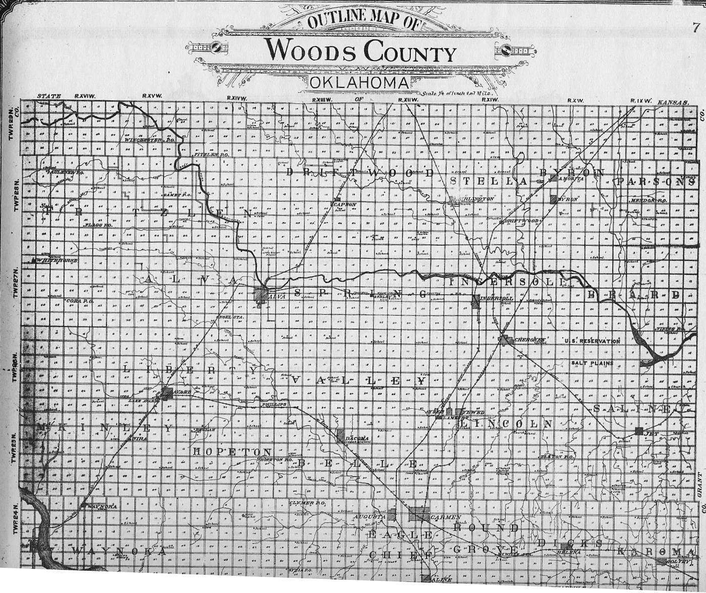
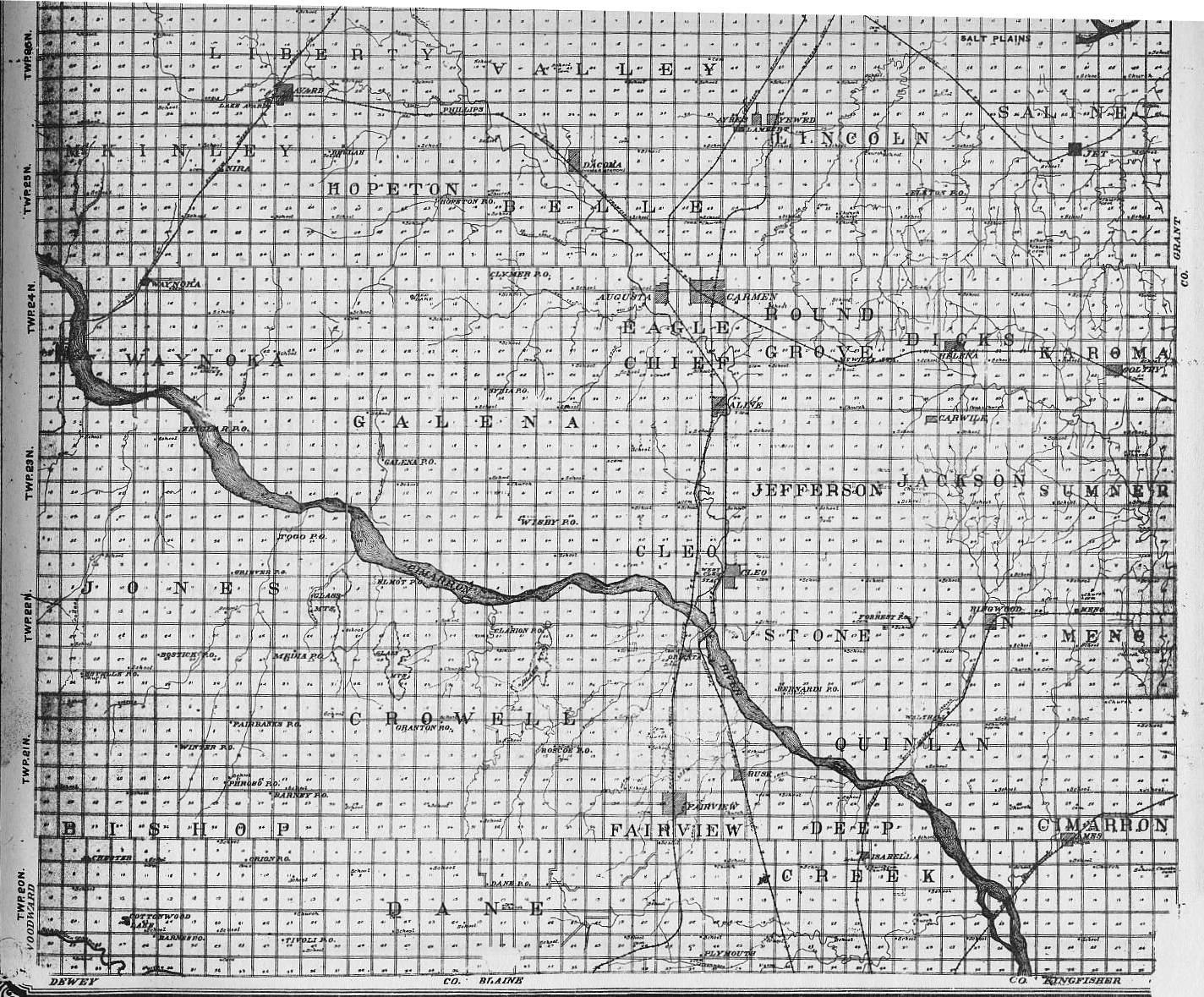
1906 Woods County Map
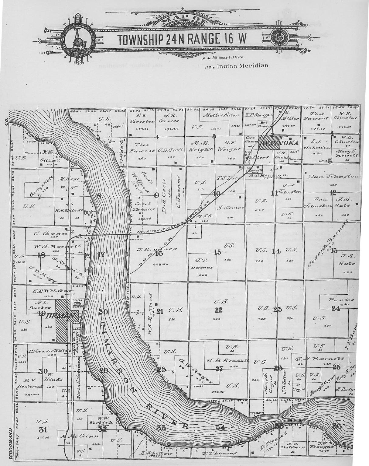
"Linda, I scanned the map of Woods County from the 1906 Standard Atlas of Woods County. It is in two scans, North and South, with a lot of overlapping in the center. My Atlas won't fit on my scanner to scan it as one page. I hope your readers find it interesting. We had reproductions of the Atlas in the Museum Gift Shop, but they have all
been sold. We do have a 2' x 3' poster of twelve townships in the Waynoka area. The posters show ownership of properties. The area covers townships 23, 24, 25, and 26 in ranges 14, 15, and 16. I also scanned T24-R15 (shown to the left) which shows 1/12 of the information that is on the poster. That particular township has Waynoka and Heman in it. I didn't lay the book on the scanner straight, so there's a small area missing on the lower right. For those interested in the poster, please email me (Sandie) at waynokahs@hotmail.com. Incidentally, the Atlas is 100 years old this year. Do you know when M County became Woods County? I think I read it somewhere... don't know where. It was apparently before statehood." -- Sandie Olson
| View or Add Comments (0 Comments)
| Receive
updates ( subscribers) |
Unsubscribe
| © . Linda Mcgill Wagner - began © 1999 Contact Me | |